Google street view

Status
Not open for further replies.
.
um... nebraska.

they don't show streets there, to confuse the tourists.

i was approaching lincoln one night after midnight, and got lit up
(van with california plates)

the officer had me on the side of the road for about 30 minutes,
while he searched my vehicle for drugs and guns with a dog.
finding none, he could't arrest me and seize the vehicle, so he
informed me it would be a safe and good thing if i were to check
into the motel a mile ahead, and get some rest.

he followed me there, and sat outside till i checked in, and bought
the room, then drove off.

i went into the room, used the shower, went potty, went back out, got in the
van, and drove to my destination, chicago.

i don't need no map details, as i'll NEVER enter that state again. it
was a weird experience.
Try driving a big rig, not just in NE but about anywhere. They like to target them. My dad has many stories of incidents involving stupid actions by cops.

We do have one State Trooper in my area that I wish would go somewhere else. Most of the rest including city and county officers seem pretty reasonable.
 
The UK Ordinance Survey is the most accurate in the world, where it muddies the waters is with this little gem.

Peel Street
formally known as Fulforth Street

Formally? As opposed to in friendly conversation? Or is it a British thing?

Or maybe they actually meant "formerly" (victim of misprint:D).....

Could really be meant to be an aide in the instance when you converse with the natives- but if that's the case, wouldn't it be better to say something like:

"popularly known locally as xyz street".... etc?
 
At my old house, you could see my dog watching the google car drive by. He was inside a wireless fence.

Patches.jpg

If you actually install google earth, it gives 3D images from above - those are pretty cool. Its hard to see in one photo, but even small objects (like cars and bushes) have height, and you can pan and zoom.

arch.jpg
 
161227-1230 EST

Since I was criticized for no link on my pole transformer here are some other links:

Building where my son's shop is, three phase open delta (two transformers), seven CNC machines on a 240 V 200 A service with each machine rated about 80 A and some other machines plus lighting load, I haven't looked at peak current load, but no problems, need to look sometime. This building has a number of air conditioners. Crain working on construction of new U of M building on S. State Street. Ann Arbor Railroad tracks are just behind the building. Just the other side of the tracks is the cellphone tower.

2280 S. Industrial
https://www.google.com/maps/@42.253794,-83.7344366,3a,75y,246.3h,92.56t/data=!3m6!1e1!3m4!1sVxTks_47gvo-olzbWGnv9Q!2e0!7i13312!8i6656!6m1!1e1

https://www.google.com/maps/@42.2539608,-83.7345418,3a,75y,231.84h,90.95t/data=!3m6!1e1!3m4!1sJiZ0WQY3wNWHKajSp-7Jog!2e0!7i13312!8i6656!6m1!1e1

https://www.google.com/maps/@42.253875,-83.7344877,3a,15y,208.26h,96.25t/data=!3m6!1e1!3m4!1sTqD0HGLrjlcdC68L2bidOw!2e0!7i13312!8i6656!6m1!1e1

I tried to correlate with some sattelite views, but the links won't display what I want.

My old landlord's home on Washtenaw in Ann Arbor.
https://www.google.com/maps/place/2...39bb4b1!8m2!3d42.264837!4d-83.7183882!6m1!1e1
Dates from the 1870s. This is the highest spot in Washtenaw County between Michigan Stadium and the Penobscot Building in Detroit (WWJ-TV in the 1940s). The old windmill tower on this spot was used as the microwave relay point for early Michigan football games. I lived just across the street from 1958 to 1966. Now I live a few hundred feet down the hill behind the Tuomy house.

This is our primary delta supply.
https://www.google.com/maps/@42.265...u13E8a3DIIZEqtS2EA!2e0!7i13312!8i6656!6m1!1e1

Underground wires from our substation to overhead. About 3/4 mile from my home.
https://www.google.com/maps/@42.258...PePaf0VNPdish7csIg!2e0!7i13312!8i6656!6m1!1e1

Our substation, cell-tower, and water tower with its cell antennas.
https://www.google.com/maps/@42.257...o_Wn7rtg7mjhDTQE6w!2e0!7i13312!8i6656!6m1!1e1

A sattelite view.
https://www.google.com/maps/place/2...1128465a39bb4b1!8m2!3d42.264837!4d-83.7183882

Trees do not make it easy to see.

.
 
I discovered a point in a nearby town where if you are looking at overhead "earth view" you see what is presently there today. If you go to street view you see the present building while it was under construction, but if you look at street view from a point anywhere to the east of the intersection you see the old building that use to be there. Three different items to view for the same location depending on what angle you are looking at it from.
 
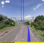
Follow the blue line.
 

Attachments

  • funny-car-photos-google-maps-hell-of-a-turn.jpg
    funny-car-photos-google-maps-hell-of-a-turn.jpg
    37.5 KB · Views: 0
Follow Google maps to my house you would:
A/ get lost
B/ wreck your car going down a fight of stairs

That reminds me of a story I heard about an early version of the iPhone maps tool which somewhere (in Alaska, maybe?) it would route you through an airport, crossing one of the runways. I don't know if anyone actually tried driving that route.
 
That reminds me of a story I heard about an early version of the iPhone maps tool which somewhere (in Alaska, maybe?) it would route you through an airport, crossing one of the runways. I don't know if anyone actually tried driving that route.

I know about a guy looking at his GPS swore he was only 22 miles away from us, not 75 miles, and that he would be right there. Sure it's 22 miles across two mountain passes that require four wheel drive and have a sphincter pucker factor of 10+ and your average speed is less than .25mph.

He didn't like that answer. We all went down the mountain for lunch before heading home and let him figure it out.
 
So I think we have established that Google maps and satnav have quirks. As I noted before, given the sheer volume of data that there is, it would be astonishing if there were zero glitches.

I have satnav in my car. It's generally on the money. But not always.
I used to visit a lot of water pumping stations, often out in the boonies so no street address. Just a post code. A bit similar to a zip code, it specifies an area.
A bit of geography for you non Brits. The main north-south motorway (and possibly the oldest) is the M1.

Anyway, I popped in the post code for this pumping station. It is about 50 yards west of the M1.

"You have arrived at your destination."
Wait a minute. I'm still on the motorway. Yes, I can see the pumping station. I'm not there Myrtle!

Well, I got there and typed in the location. That worked forever and a day. Amusing in retrospect - not so much at the time.
But it shows that the systems are not foolproof.
 
I drove by a Google car while it was filming in Orlando yesterday. I don't remember exactly where we were so I can't go look for my truck in google maps. A friend of mine passed one once and did see himself on google maps.

There was a day when you could tell google maps that you want to go from San Diego to Tokyo and it would give you driving directions to a boat ramp in Portland or Seattle, then tell you to take your kayak across the ocean to a boat ramp in Hawaii, then give you driving directions to the other side of Hawaii, down another boat ramp, and take your kayak across the ocean to a boat ramp in Japan, then up the ramp and driving directions to Tokyo.
 
Status
Not open for further replies.
Top